One of the highly used applications that team from SIT Drones has developed in 2020 is IZS Stream. The software has found use right away with the Integrated Rescue System (IRS) – especially firefighters and police officers. Use in practice then showed space for its continuous improvement, and in May 2023 a major update of the application came in the form of a new feature.
And how does the smart system work?
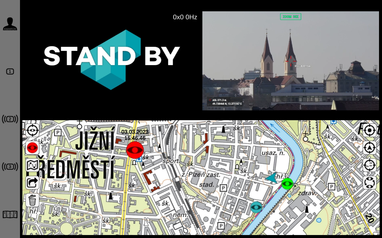
Not only the drone with camera or other ground cameras is important, but also the Teradek technology built into the handy backpack. This can stream the image as a distributed video to a server and from there to the app of the individual participants in the intervention, if they are granted access. Everything is secure, the image only gets to where it needs to be, with a delay of about one second.
The stream can be viewed on tablets, mobile devices or on a computer. The intervening components can even send simple commands to each other via our app.
The app works securely – the user has a login and password, without which they cannot get into the system. SIT Drones act as an administrator, they can assign specific video streams to individual users. Streams can also be divided for example for parallel hits (each unit will only see its own hit) or conversely (videos can be merged when a common hit is made). In total up to three videos can be combined (one from the drone and two from the ground camera).
The latest feature of the software can display suspicious points. These can be for example fire outbreaks or missing persons.
Aim of the project:
- To create a complete and secure solution for streaming data from the scene of a crisis event.
- To mark points of interest and determine the exact location of the monitored target (fire outbreaks, wanted persons, etc.).
Result of the project:
- The creation of a solution consisting of a cross-platform application that facilitates and secures the distribution of data for the IRS units (firefighters and police).
- Streamed secure transmission with a delay of one second.
And what kind of drones and cameras does SIT Drones use for IZS Stream? They are using the DJI Matrice 300 drone with the H20T Camera on it or the DJI Matrice 30T drone with integrated camera. The drone pilots are able to calculate the GPS coordinates of the area the drone is currently targeting. They are able to do it thanks to the sensor located on these cameras. Moreover, it is also possible to calculate the distance and GPS coordinates at a distance of approximately 1 200 meters.
More information is on the SIT Drones website.
-
use of drones and custom applications
-
support of the IRS
-
secure stream with one second delay