Pilsen – Analysis of Satellite Images
We care about the environment. We own analyses of satellite data of the city of Pilsen, which work with information on temperature, greenery and water.
We care about the environment. We own analyses of satellite data of the city of Pilsen, which work with information on temperature, greenery and water.
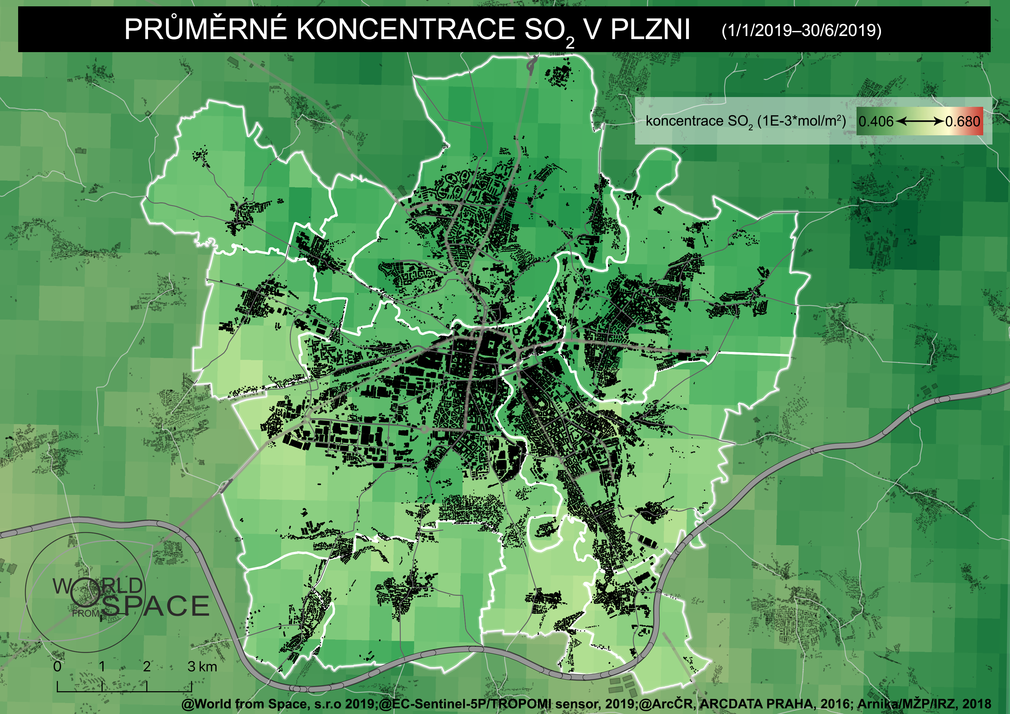
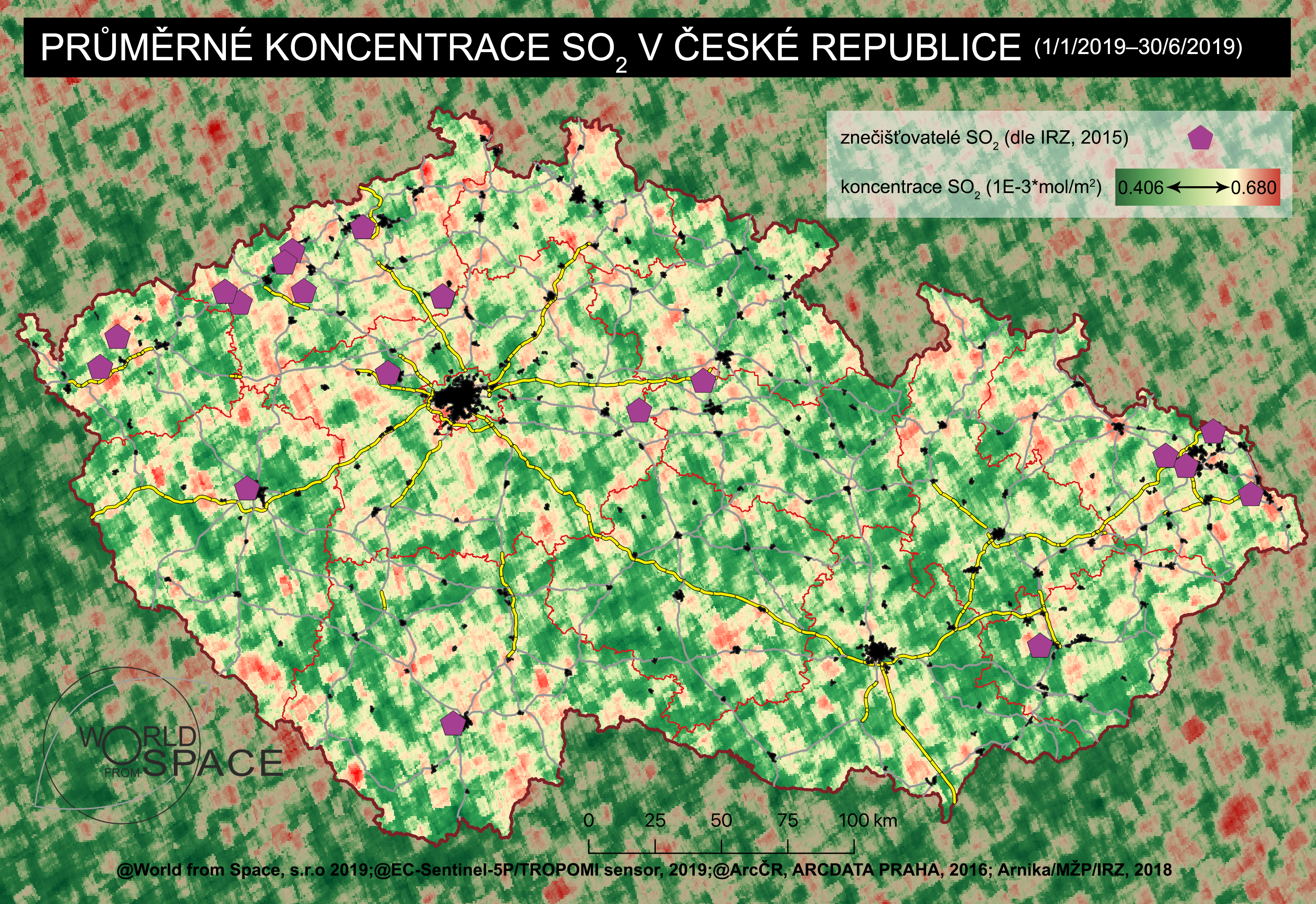
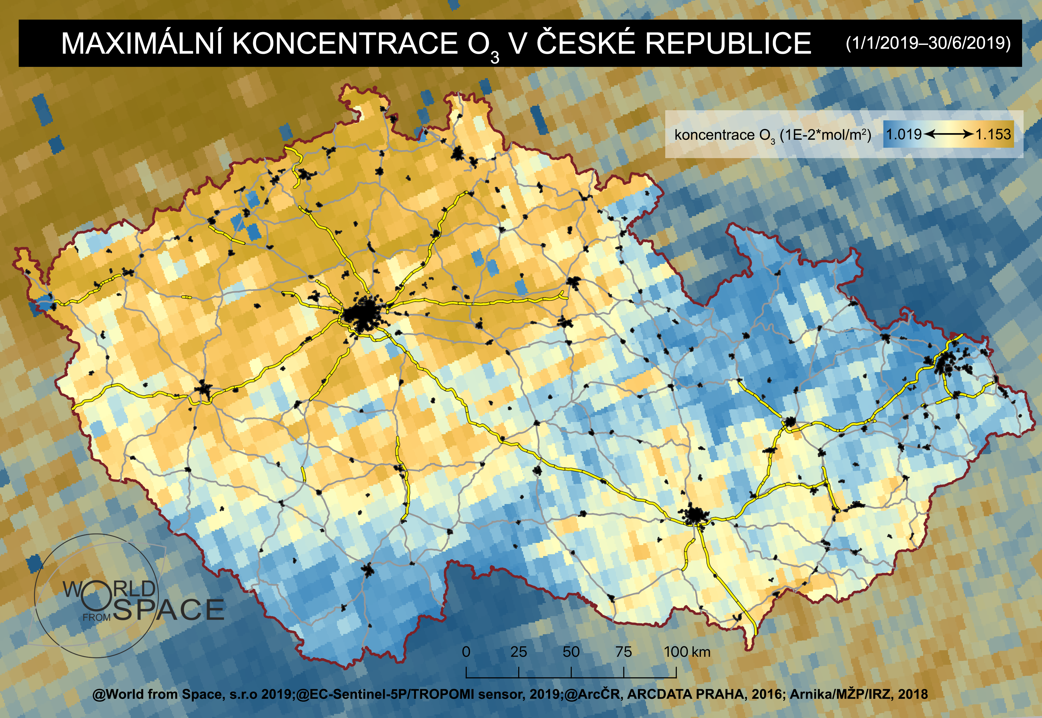
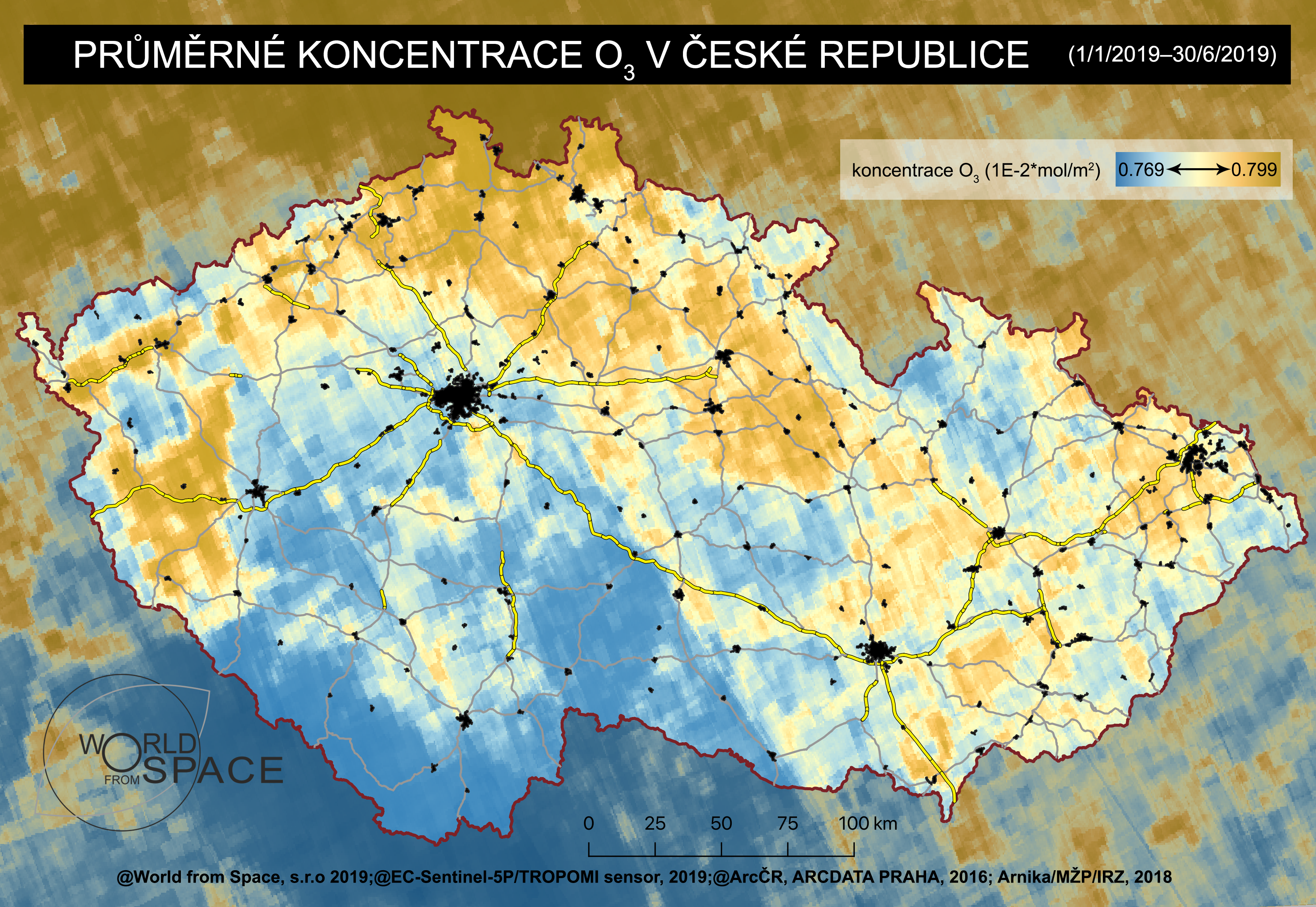
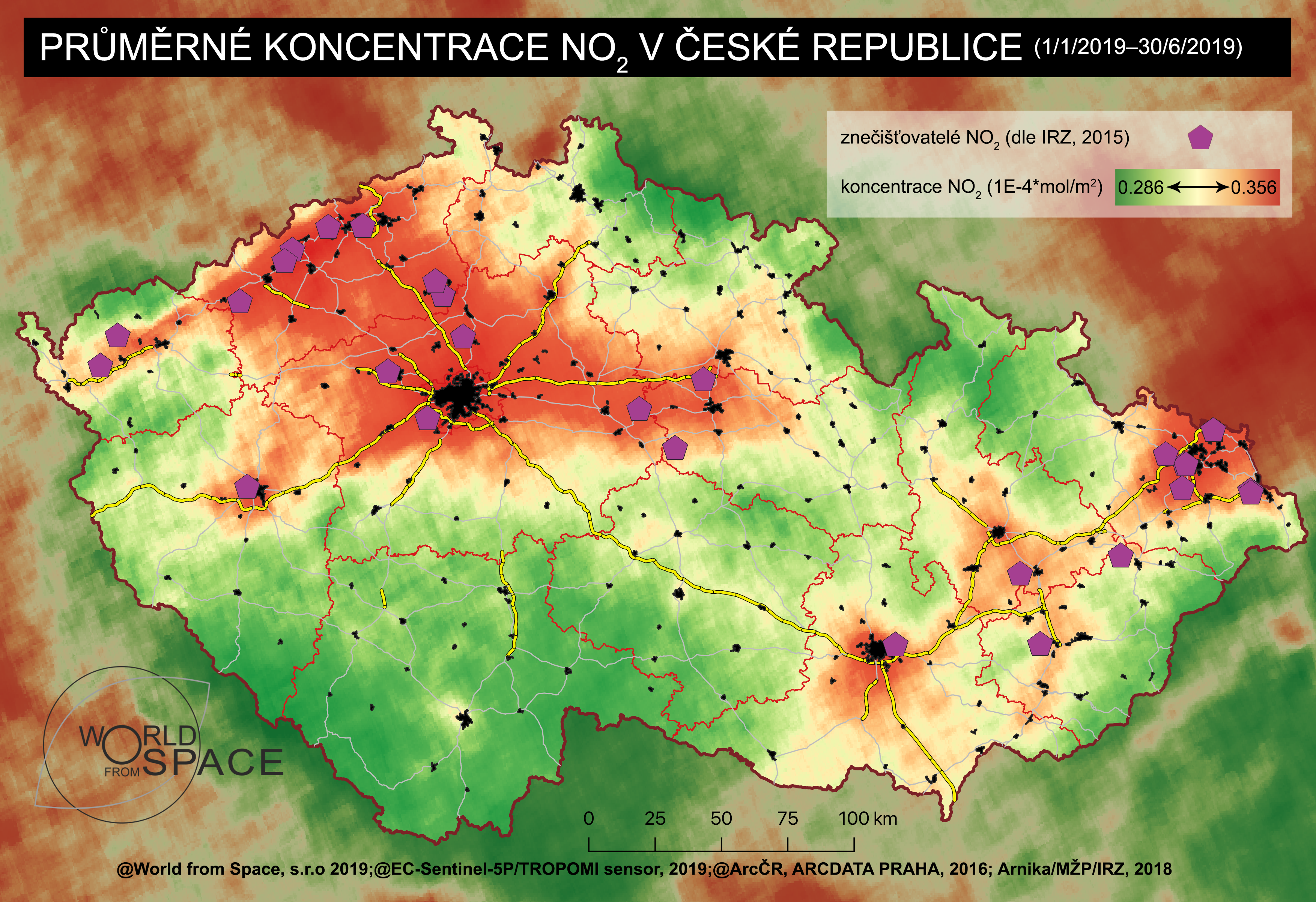
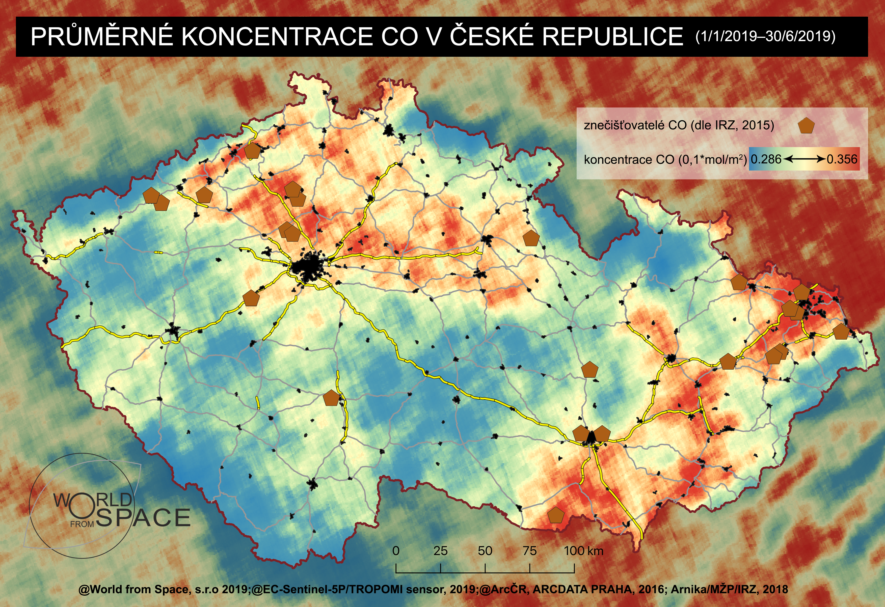
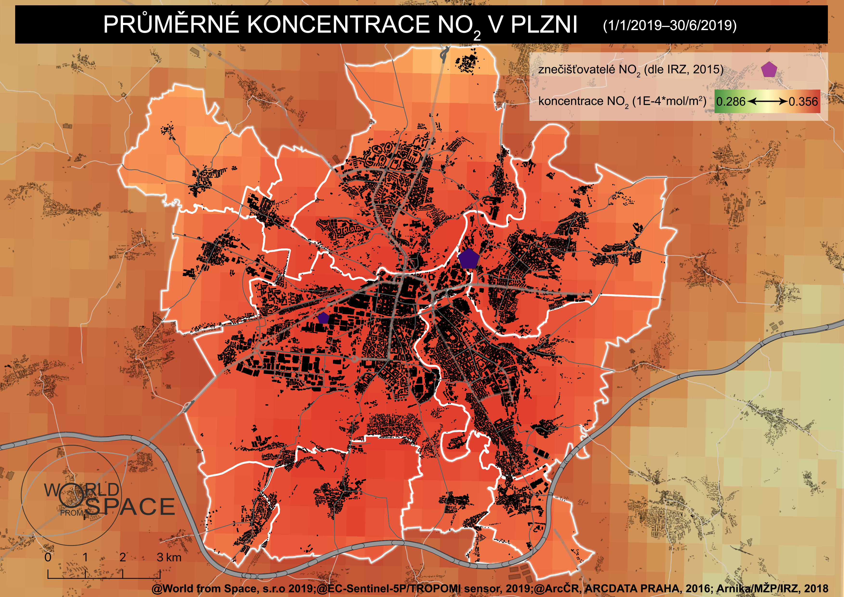
In cooperation with World from Space s.r.o. we have analysed satellite data of the City of Pilsen. The first analysis worked with the perspective of temperature, greenery, and water. The second one worked with the quality of air for the period from January to June, 2019.
Main findings:
Satellite analysis of Pilsen air (PDF, 28 MB)
Map outputs (ZIP, 30 MB)
Data files (ZIP, 1 MB)
Pilot Project Satellite Monitoring Pilsen 2018 – Summary of Findings (PDF, 27 MB)
Map Outputs (ZIP, 94 MB)
Drought Study 2015 – 2018 (PDF, 63 MB)
Map Outputs (ZIP, 54 MB)
Open data:
Vegetation (ZIP, 336 MB)
Humidity (ZIP, 106 MB
Temperature (ZIP, 31 MB)
Satellite analysis of Pilsen air, January to June 2019
The project is implemented by the Information Technology Administration of the City of Pilsen