3D model viewer – new application for IRS
The application creates a 3D model of the scanned object on the spot and in real time. It is often used by emergency services to examine an object before they enter it during an intervention.
The application creates a 3D model of the scanned object on the spot and in real time. It is often used by emergency services to examine an object before they enter it during an intervention.
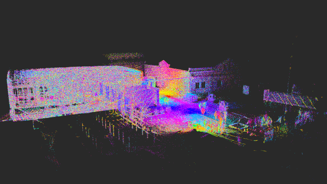
The list of applications developed by SITMP includes a new application, which is the result of the work of SIT Drones. It is a viewer of 3D models – the so-called point clouds, developed for Integrated Rescue System (IRS) by our drone pilots and operators, that are also officially part of IRS. In the Czech Republic, this cooperation is unique. In fact, their frequent task is to scan buildings and objects even before the intervening units enter them. If the project documentation is not at disposal, the drones are able to show even details in the form of closed doors, windows and other obstacles is the only clue.
However the creation of the app does not mean the end of the work, quite the opposite. Our SIT Drones team is already working on improving it. They are going to add a feature that can show in the acquired model the points where, for example, the wanted persons are located, thus possibly facilitating search and rescue missions.
You can read an article about what drones are used in the interventions or how the whole technology works directly on the SIT Drones website.