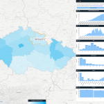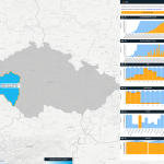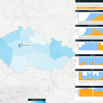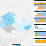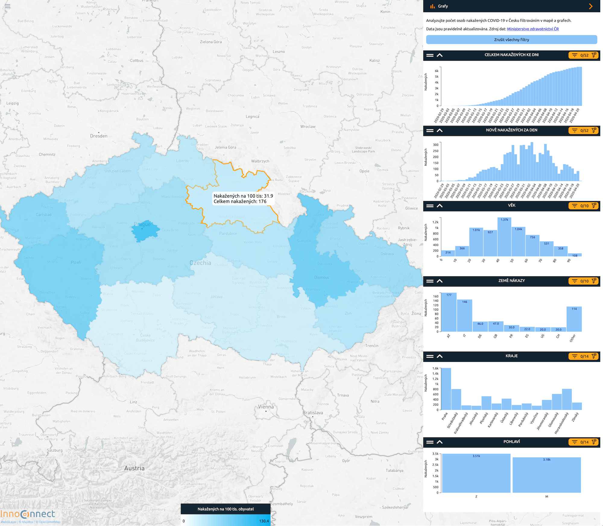
The local start-up company InnoConnect, which is based in the city technology park in Cukrovarská Street in Pilsen and focuses on processing “big data”, has presented a new interactive map of the spread of COVID-19 in the Czech Republic. The map of COVID-19’s spread was created with open data from the Ministry of Health of the Czech Republic and provides much useful information.
The application allows you to analyze the number of people infected with COVID-19 in the Czech Republic using interactive filtering in the map and graphs. The data can be analyzed selecting bar graphs and marking regions directly in the map. People can choose different combinations of filters, for example by selecting one country of infection; it is also possible to compare cases with origin in that country and their distribution in time, in regions and by age and sex. You can also select only the age group over 70 and view the regions with the highest number of infected seniors.
The map is available on https://mapa-koronavirus.innoconnect.net/.
For more information go to the InnoConnect website.